

History
On the 13th of July 2014 at 7 am, the Rockman race was born and the first swimrun outside of Sweden. It marked the start of the international swimrun journey, next to ÖTILLÖ Engadin, which started a few hours later. The course was designed based on the myth and local legend of Rockman.
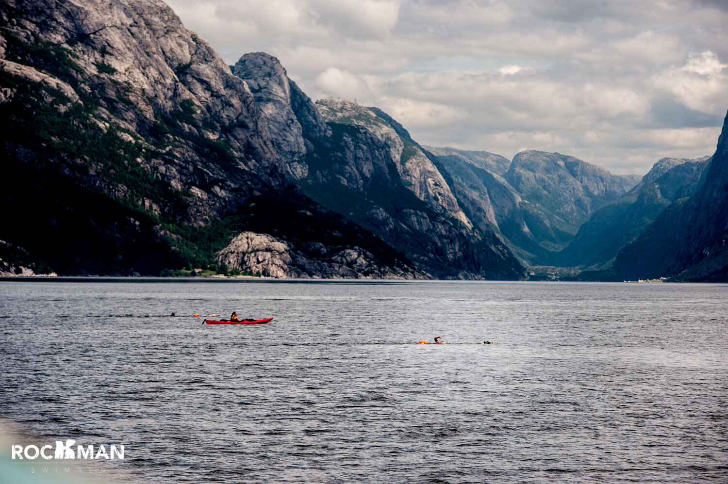
The 2014 course was brutal, long, and dubbed as “the impossible race” from the fjord’s local inhabitants. Spanning some 50 kilometers in total, the race was touted as a way for you to see three tourist attractions (Preikestolen, Flørli 4,444 wooden stairs and Kjeragbolten) all in one day. 14 teams undertook the first race.
After that first race, it was deemed “too hard”. In 2015, the course was shortened. Still, a tough-as-hell race, it basically cut off the long 13-ish mile trek to the Kjeragbolten. I undertook that 2015 race as my first swimrun. You can read all about it here.
Since then, I have begun helping Thor Hesselberg, the race director, with Rockman and over the past 3 years have become the co-race director. Don’t let the title fool you, Thor is still the man in charge and holds knowledge, experience, is well-connected and not to mention, he’s Norwegian. But, for the past three years, I’ve been lucky enough to spend a week in the fjord, marking the race course and helping with all of the logistics and tasks. It’s a big undertaking, but I get to spend some quality time in a place I love so very much.
Preparations
This year is the 10th anniversary, so Thor and I decided that it was time. The swimrun community had evolved enough, become knowledgeable enough, become experienced enough, and strong enough to take on “the impossible race”. The O.G. course. The one deemed “too hard”. Not only that, but we even added a little extra to make it EVEN HARDER.
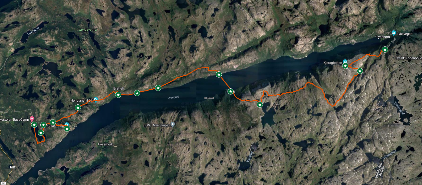
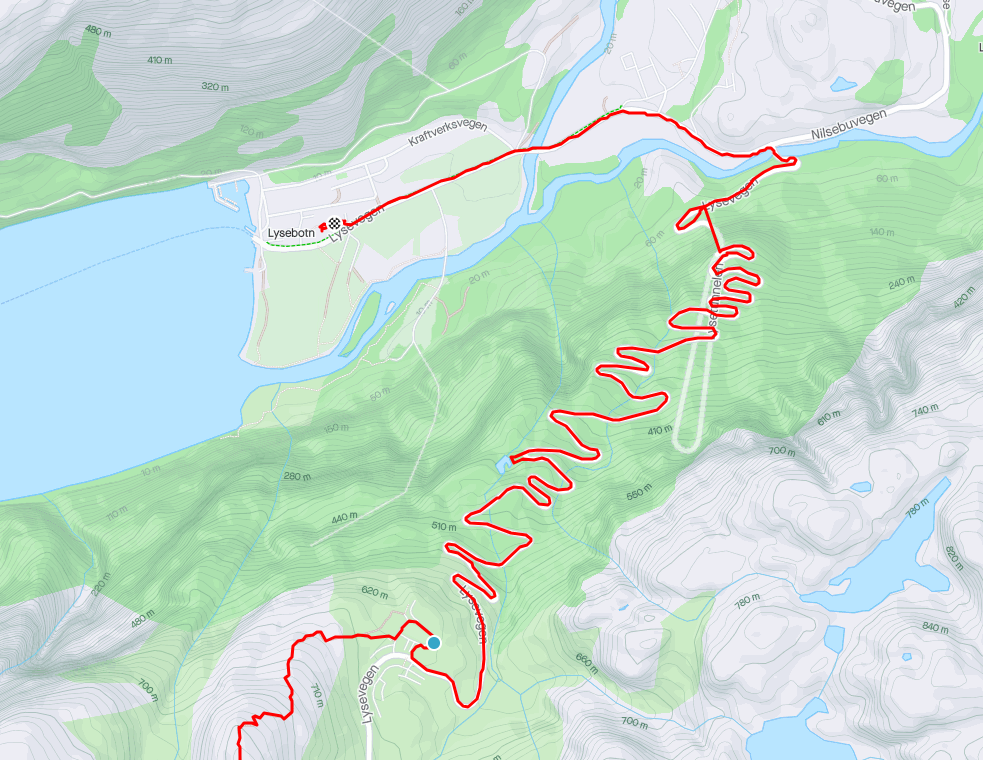
We planned and came up with a course. My job: mark the course from Priekestolen to Bratteli on one day and from Flørli to Lysebotn on the another. The latter of which was 13ish miles (20k). Piece of cake, right? Wrong. That last section of the race would start with climbing the 4,444 wooden stairs of Flørli, then a long trek with some of the most technical, muddy sections any race has ever had. Throw in 6,500 feet (2,000 meters) of climbing and you have yourself one tough task.
Knowing that we could use a little extra help, we recruited Trista, an experienced swimrunner and Rockman veteran, to join our circus. As we geared up to mark the course, the weather decided to throw shade at us. Just typical mountainous drama, with the weather changing every hour or so. The day we planned to mark the last portion of the course, the forecast called for 30 mph (13.5 m/s) winds. So, we boldly decided to conquer two days worth of marking into one day. What could possibly go wrong?
This year, marking the 10th anniversary, Thor and I decided that it was time. The swimrun community had evolved enough, become knowledgeable enough, become experienced enough of, and strong enough to take on “the impossible race”. The O.G. course. The one deemed “too hard”. Not only that, but we even added a little extra to make it EVEN HARDER.
We decided that it would be smarter for two of us to cover the two long sections, because let’s face it, marking the course out in the wilderness is no solo gig. Trista and I decided to conquer the task. This move also freed up Thor to work his magic around the basecamp and Songesand, while juggling a million other things over the phone and in meetings. It’s all part of the majestic chaos!
Knowing that this day had the potential to stretch on forever, and possibly even extend into the night (despite the sun setting around 11pm), we prepared all the marking materials, an abundance of snacks, emergency supplies, a Garmin inReach, and, of course, headlamps.

On Wednesday, before the race, we kicked off the adventure from basecamp at a fashionably late 9 am, after having to coordinate with the basecamp folks about boats, paddles, and life vests for the water support team. We set out onto the trail with full packs and smiles on our faces. The day was stunning, well, mostly, but we’ve learned that if you’re not a fan of fjord weather, just stick around for a few hours – it’s guaranteed to switch things up on you.
Our journey from basecamp to Bratteli felt like it went by in a flash. We miraculously marked the entire 10K stretch in just 4 hours. If that sounds like a long time, well, marking a race course is no walk in the park – especially Rockman since it is so damn technical. To add to the fun this section also involves around 2000 feet (610 meters) of elevation gain. But as I tell the racers, this side of the fjord is only the warmup.


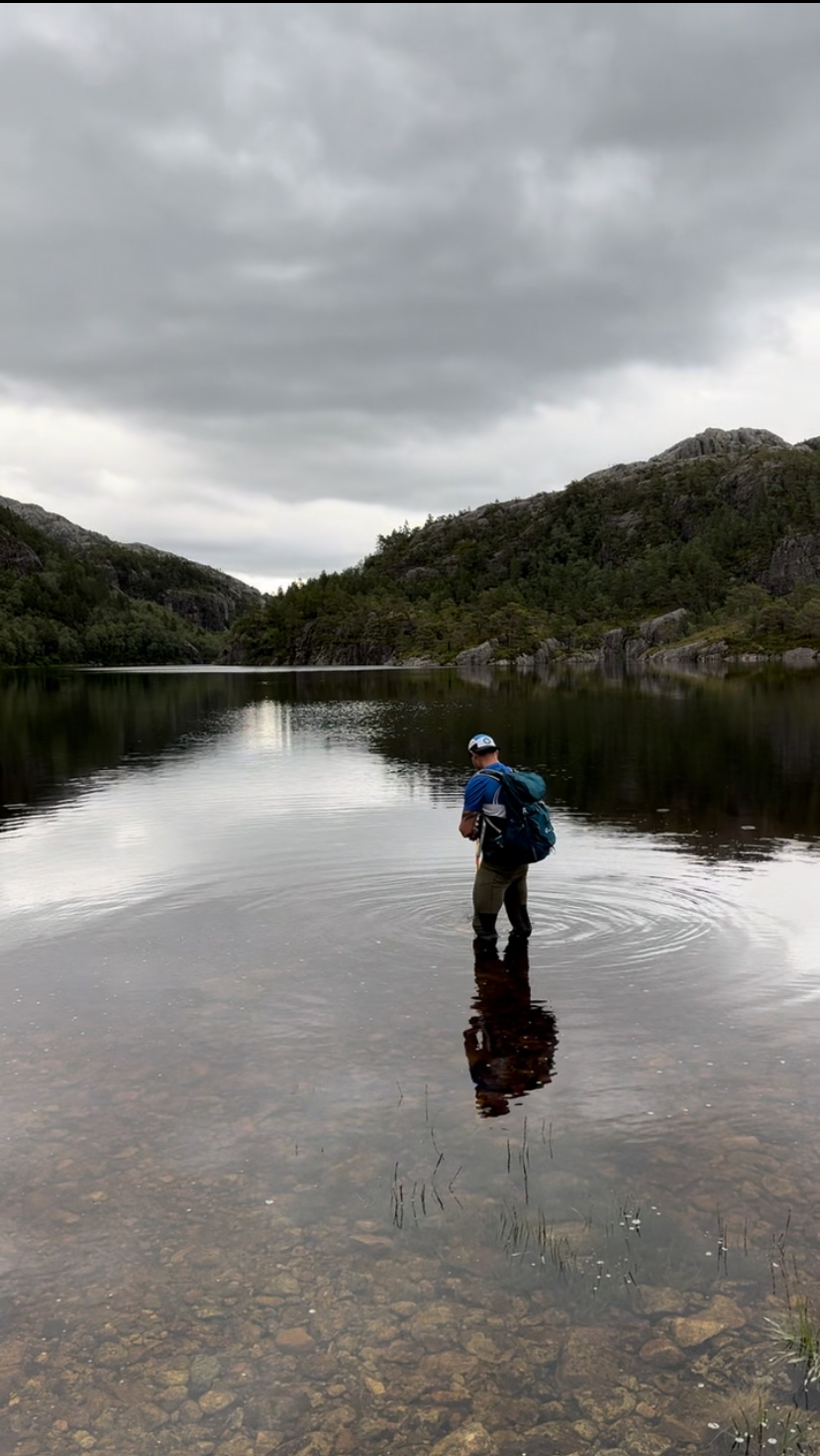
We spent most of our time marking intersections of trail that would be confusing. Racers, for the most part would follow the permanent, red T trail markings. Where they needed to deviate from the course, and where intersections existed, we would add red/yellow biodegradable flagging tape. We marked around Skogavatnet, the second lake we would swim during the race and took water temps to let the racers know about the chilly waters.

When I was marking the Flørli side of the course two years ago, I suddenly found myself in a race against time, sprinting downhill through an insanely technical section just to catch the ferry. Fast forward to this year, and in true Marcus fashion, there we were again, frantically trying to make it in time for the ferry. If we missed it, we’d have to backtrack and hike all the way back to basecamp, effectively putting an end to our plan for marking the back half of the course. Luckily, we made it with time to spare (even enough time to check the water temp) and we were on our way to Flørli.


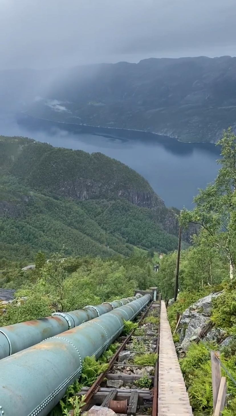
The journey up the Flørli side of the fjord kicks off with the famous 4,444 stairs. Climbing these bad boys will lift you up a whopping 2,400 feet (that’s 740 meters for the metric folks) in just under a mile (1,470 meters). We had a quick pit stop for some fuel from Hessel Haker, the jack of all trades at Flørli. He’s the cafe owner, host, and master chef. After that delightful encounter, we geared up for the stairway.

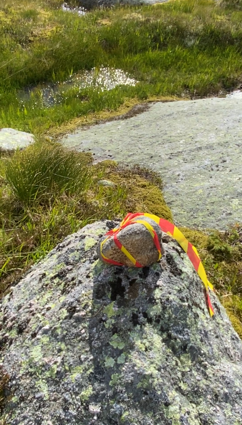
At the top of the stairs, there were two lakes that needed to be marked for swimming and an off-trail section in-between. We could have taken them around on the gravel road, but what fun would that be? This little section took quite a bit of time to mark because lots of flagging tape is needed to keep the racers from wandering off course. With most of it being stone and barren, with only tufts of grass here and there, there’s no trees or shrubs to tie tape to. Instead, we tie up rocks like little birthday presents.

Then came the epic 13-ish mile adventure to the finish line. Now, for the average runner, 13 miles may not sound like much, right? It’s just half of a marathon. Lots of endurance and ultra runners breeze through 13 miles during a weekend brunch, no sweat. But this is Norway! This next part of the course is where I lovingly inform racers that the real race begins. We’re talking about some of the most technical running on the entire planet. I had one racer call it “outrageous”. Get ready for barren rock, fields of boulders, and a casual 6500 feet’s (1980 meter’s) worth of climbing. And the cherry on top? It’s all deep in the wilderness. No roads, no jeep trails, and let’s not forget the spotty phone service. The only way out? Well, it’s either by foot or a chopper airlift.

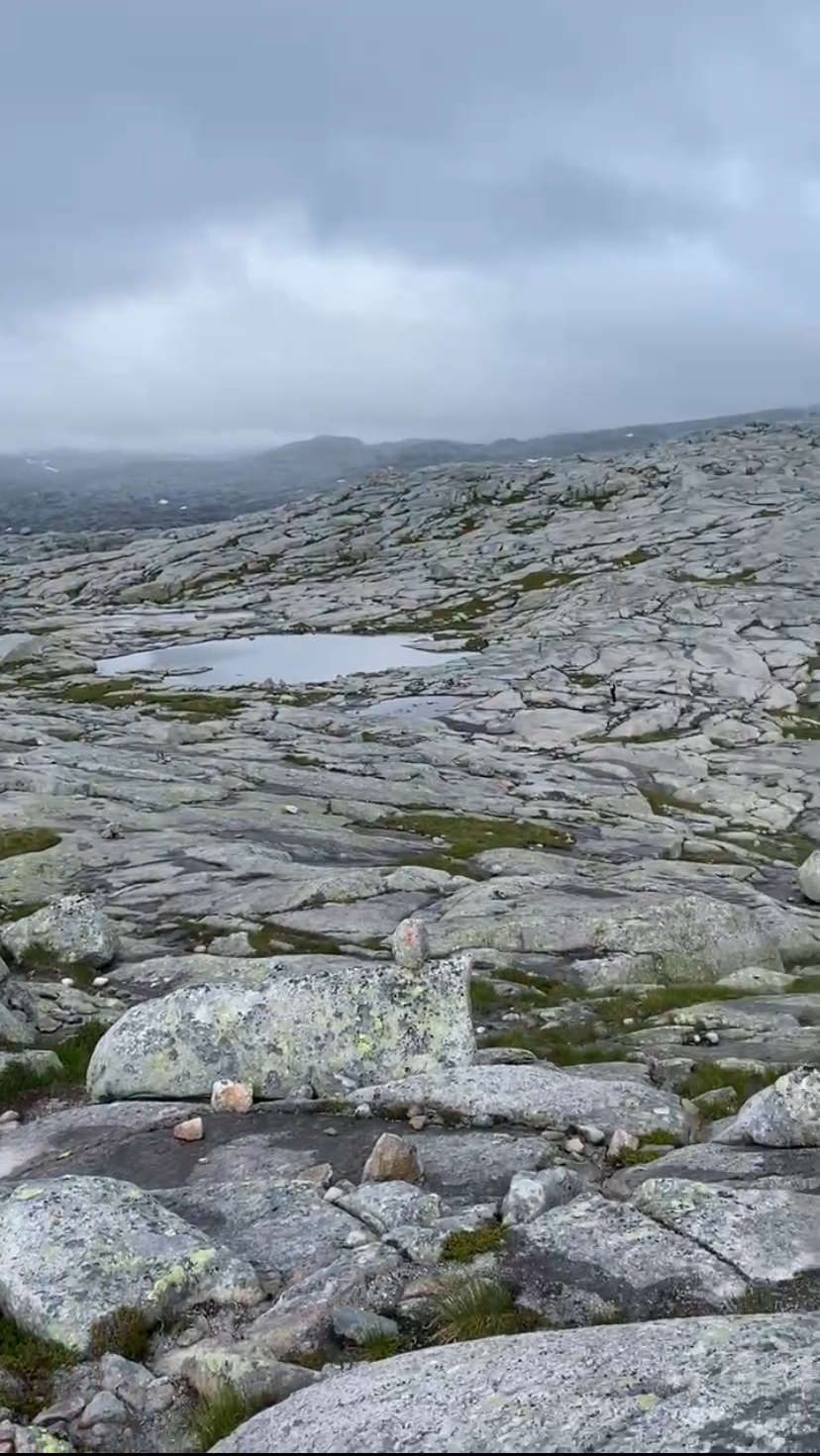
Another hilarious issue we face in this neck of the woods is the optical illusion of closeness. That tiny rock over there, appearing as the size of a suitcase, turns out to be as large as a car! And don’t be fooled by the seemingly small puddle – it’s actually a full-blown lake! This mind-bending trickery makes estimating distance a real head-scratcher. Case in point: take a gander at these photos. Can you spot Trista amidst this visual chaos?


We somehow managed to spend 10 hours on this section of the course, perfecting the art of marking intersections and turning T stones into beacons. I’m telling you, we turned over a hundred of those things! Our main goal? Ensuring that racers could spot them, even in their sleep (or at least in the dark). But hold on, we were also considerate enough to make sure that hikers coming from the opposite direction wouldn’t miss them either.
We faced a medley of rain, tons of wind, and sporadic bouts of sunshine. The landscape was simply stunning, with countless uphill climbs, an abundance of sheep, stream crossings, and more rocks than we knew what to do with. And just when we thought we’d had enough of rocks, Norway generously treated us to an excess of mud. We’re talking about mud that could swallow your shoes and reach up to your knees. Despite the sun setting at around 11pm in this part of the world, when we arrived in the Kjerag area, we found ourselves navigating in darkness with our headlamps.


As we crawled our way up the final two climbs, we were rewarded with breathtaking views of the fjord and Lysebotn, our final stop for the night, ahem, morning. We made it to the Eagles Nest, which is the finish line of the race, at around 4 am. We still had a long and seemingly never-ending journey down the winding paved road to Lysebotn. Picture this: a 2,000-foot drop to sea level, so steep that the crafty Norwegians had to bury one of the hairpin turns into the side of the mountain, a tunnel to make the final 400-foot drop.
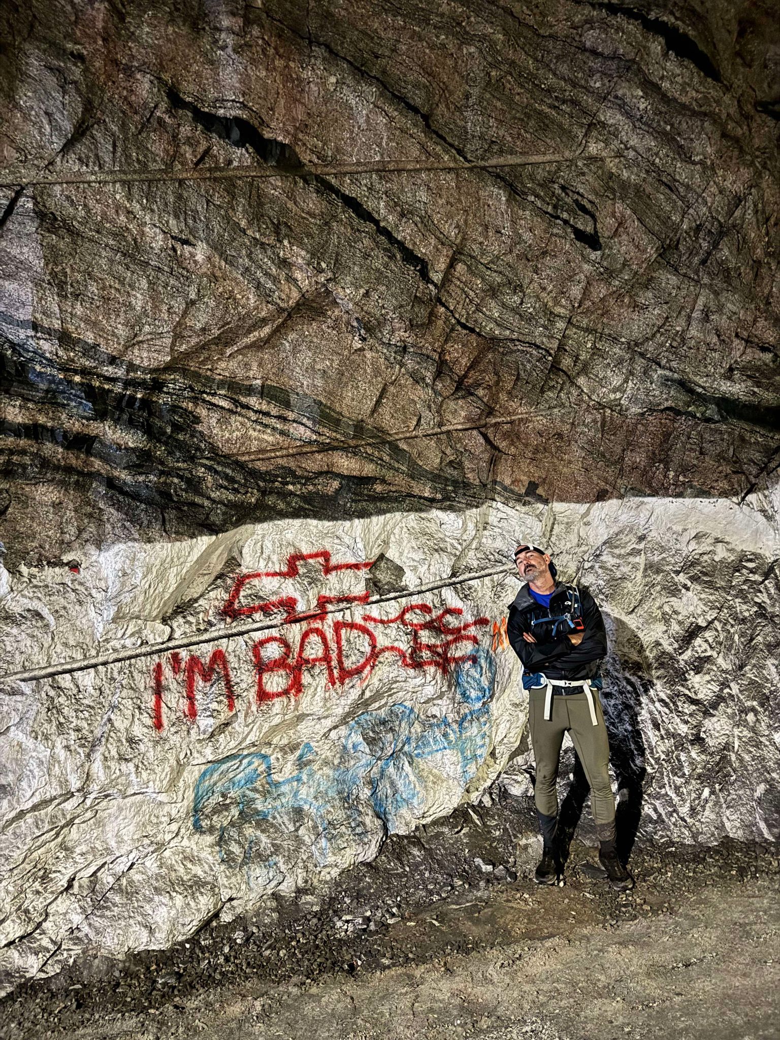
4:30am photo from the tunnel
Our grand plan to reach Lysebotn by 10pm turned out to be more of a fantasy than a goal. Our lovely host at the Lysefjorden Tourist Cabin, Hilde, had graciously intended to feed a pair of exhausted runners. Despite knowing we wouldn’t arrive on time, we gave her a heads up and she promised to leave a pot of lapskaus, a hearty Norwegian stew, in the guest kitchen for us. When we finally made it to the Tourist Cabin, we dove right into the feast without even bothering to change out of our wet, muddy clothes. The stew was so scrumptious that we managed to polish off the entire pot.

Part 2 coming – To be continued…

Great race report! I am new to SwimRun and will be doing Austin in November 2024. Any chance you have a special discount code for ArkSports that gives you credit. I have been reading some of your posts on slowtwitch and now follow you on IG too. Very helpful info and I appreciate you!!